ASTM D6433
Pavement Condition Surveys (PCI)
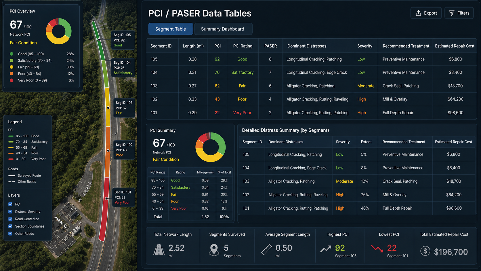
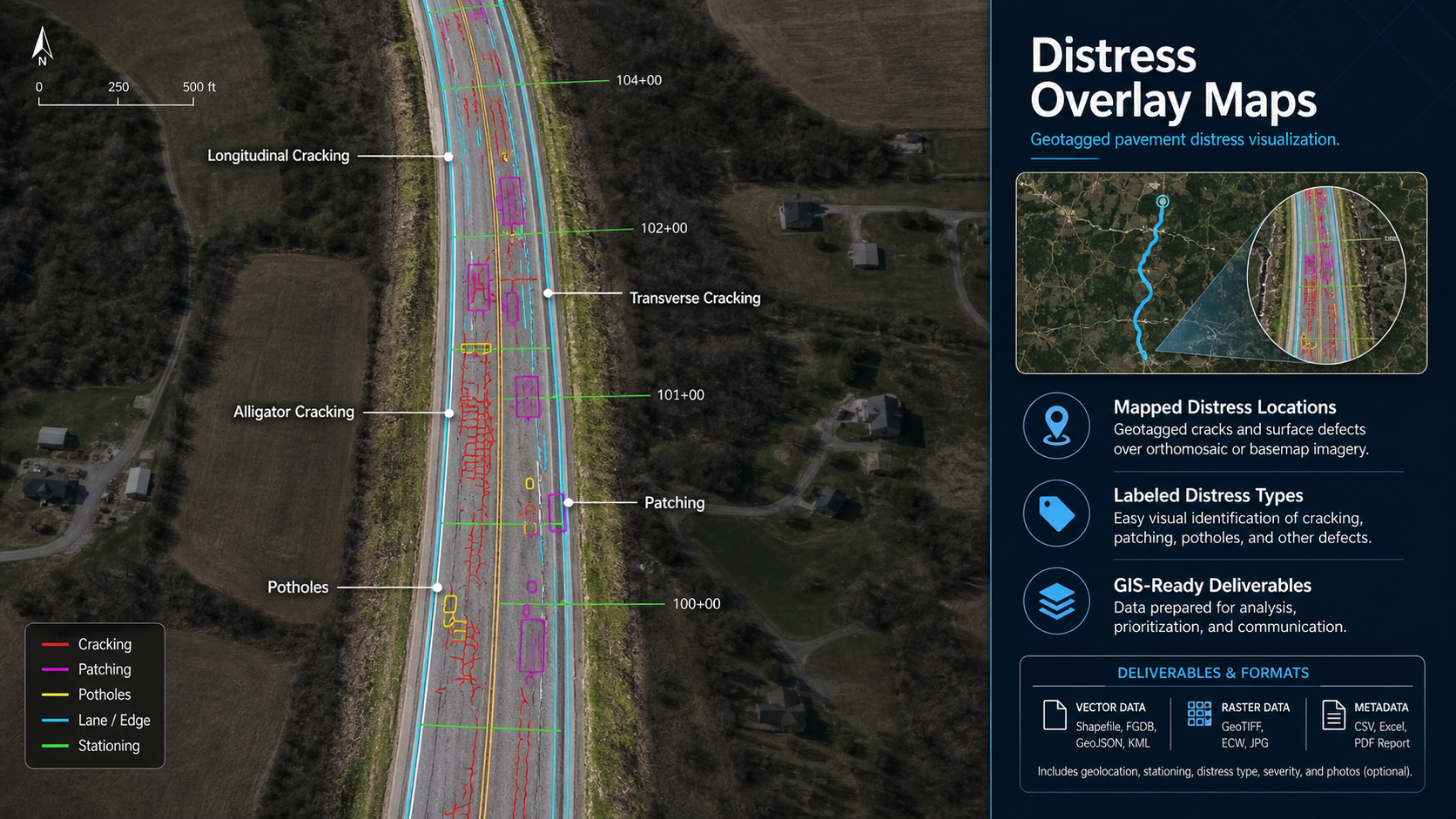
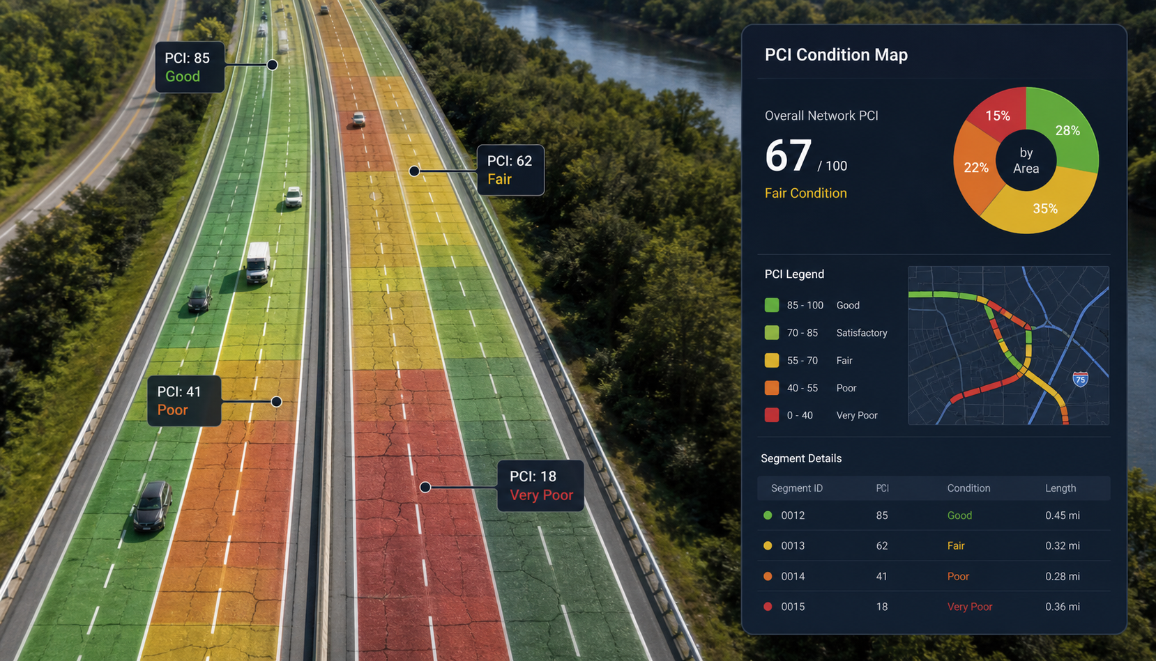
IIHUB conducts ASTM D6433-compliant PCI surveys for roads, airport pavements, parking lots, and other paved surfaces. Our process combines drone-based high-resolution imagery with computer-vision-assisted distress identification to deliver objective, scalable, and reproducible pavement condition ratings.
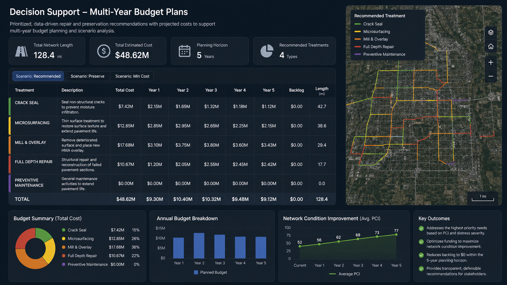
Each distress is identified, classified, and quantified according to ASTM methodology. Results are compiled into PCI maps, distress overlays, geotagged imagery databases, and PAVER-compatible outputs — giving your engineering team everything needed for rehabilitation planning and asset management.
- ASTM D6433 distress identification and quantification
- Computer-vision-assisted rating for objectivity and scale
- Geotagged distress imagery at centimeter resolution
- PCI maps, crack maps, and distress overlay outputs
- PAVER-compatible and GIS-ready data formats
- Maintenance and rehabilitation prioritization recommendations
ASTM D6433
PAVER
FAA AC 150/5370
GIS-Ready