What You Receive
Every Deliverable, Explained
Each project scope determines which deliverables are included. Most projects combine several of the following into a complete package.

PCI Condition Maps
Color-coded pavement condition index maps showing PCI scores by segment. Immediately readable by engineering staff, managers, and elected officials. Linked to full distress inventory.

Geo-Referenced Orthomosaics
High-resolution, geo-referenced orthomosaic imagery of the entire surveyed area. Sub-centimeter pixel resolution captures fine distress detail. Suitable for GIS analysis, design, and stakeholder communication.
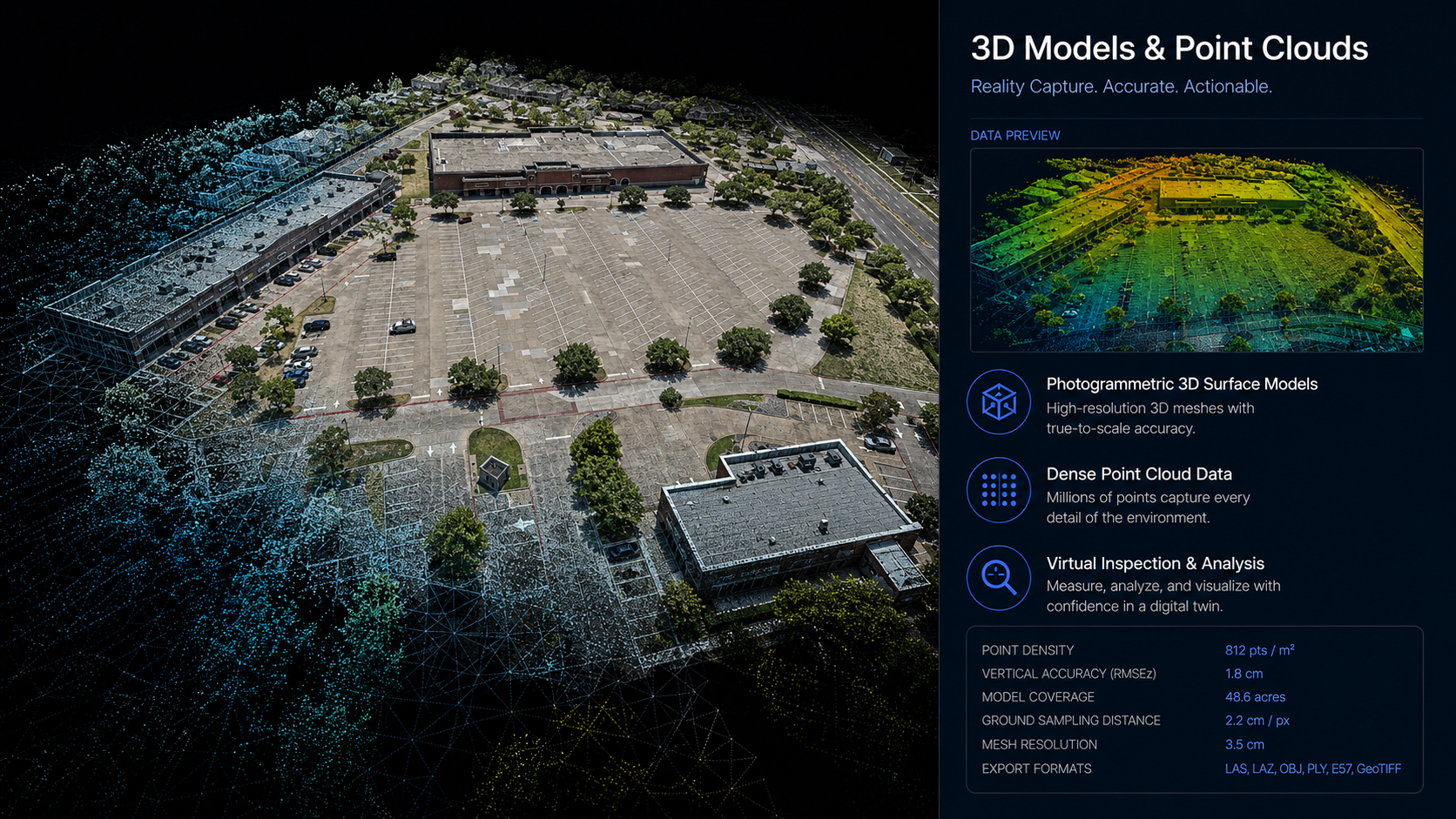
3D Models & Point Clouds
Photogrammetric 3D surface models from drone imagery. Navigable digital models for virtual inspection. Point cloud data for elevation analysis, volume calculations, and structural deformation detection.
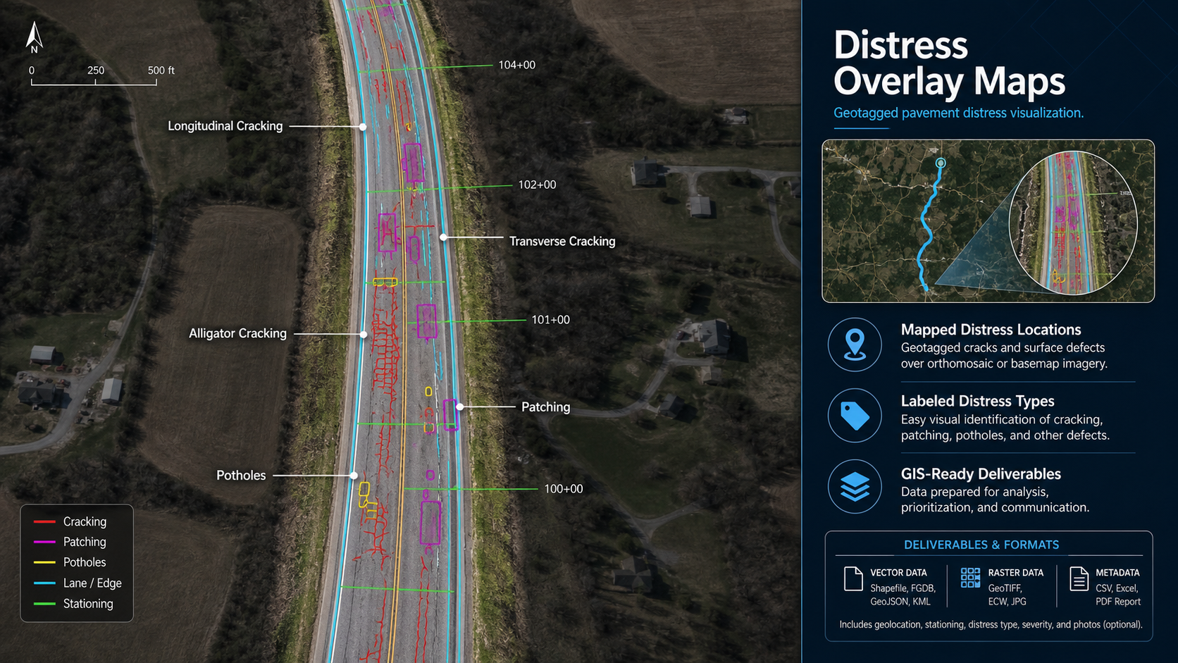
Distress Overlay Maps
Geotagged distress locations mapped onto orthomosaic or basemap — showing crack patterns, rutting, surface failures, and other distress types by location. Queryable by distress type, severity, and PCI impact.
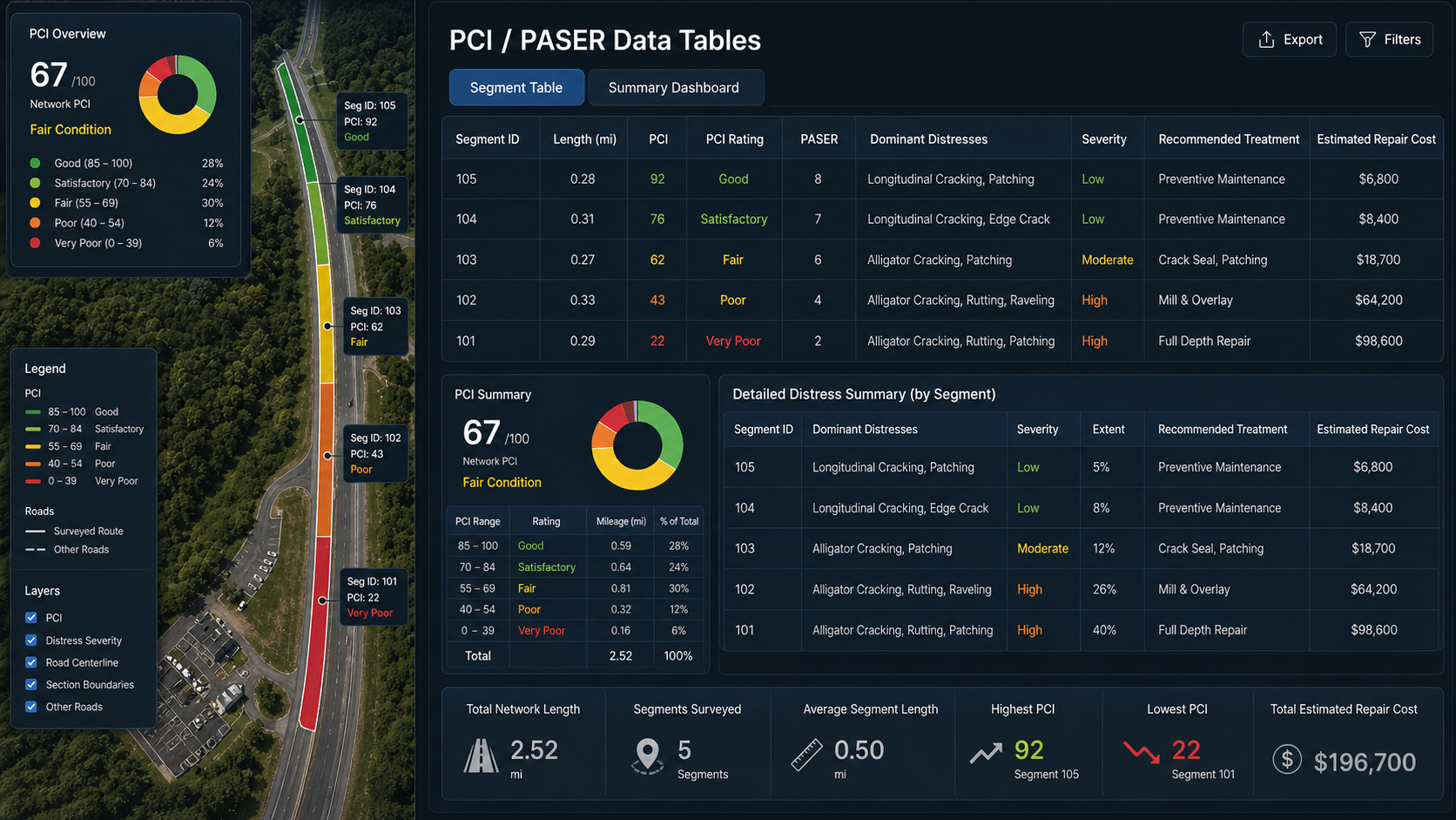
PCI / PASER Data Tables
Tabular condition data by section — including segment ID, length, area, PCI or PASER score, primary distresses, recommended treatment, and estimated repair cost. Sortable and filterable.
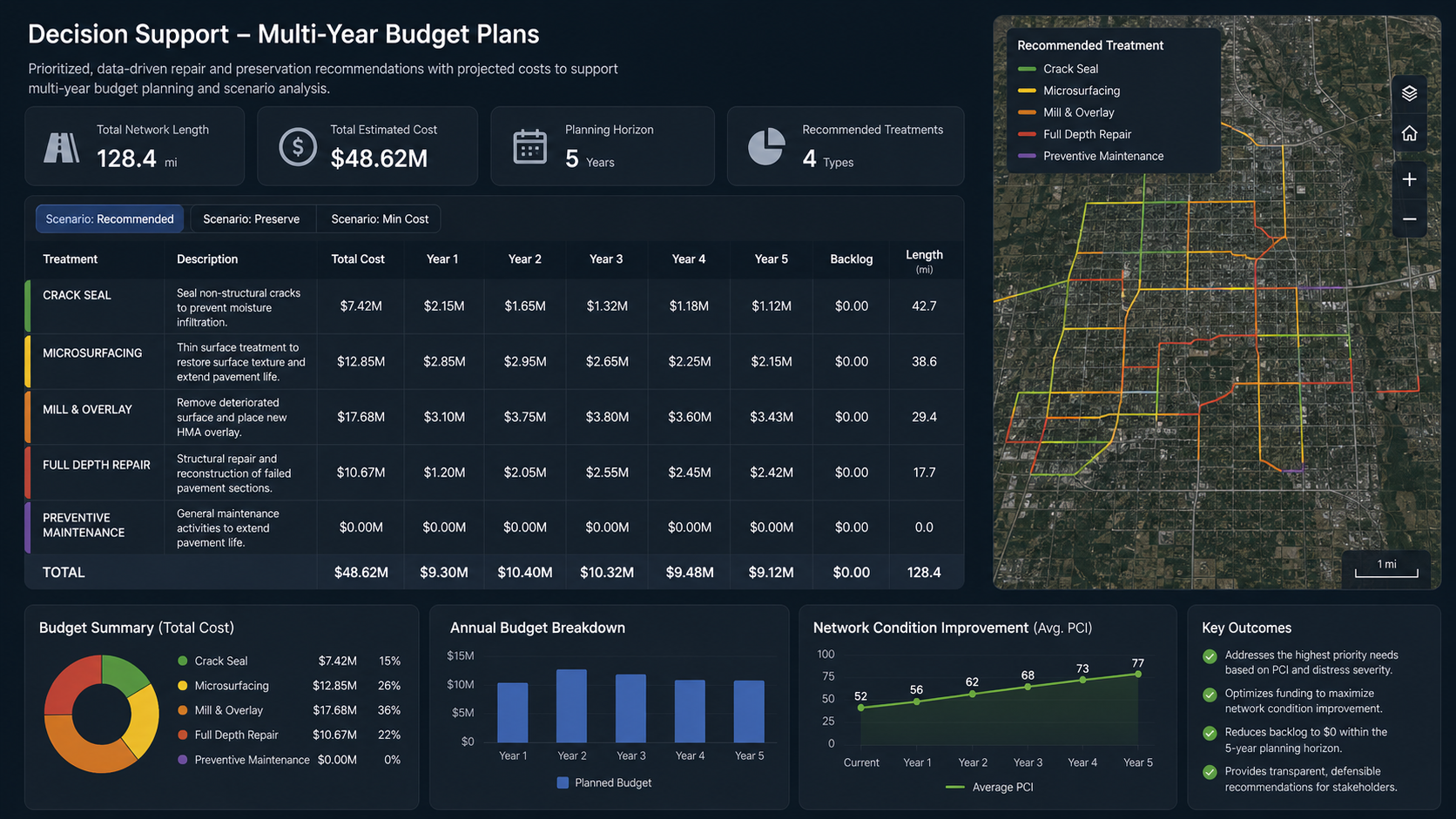
Multi-Year Budget Plans
Prioritized repair schedules organized by year, with recommended treatments (seal coat, crack filling, mill & overlay, FDR) and projected costs per section. Designed for budget requests and capital planning.
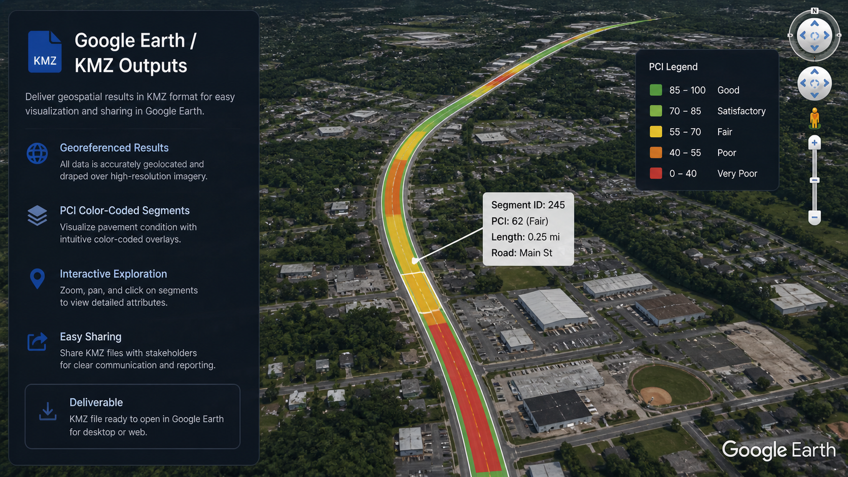
Google Earth / KMZ Outputs
KMZ-format deliverables for immediate visualization in Google Earth. Condition data, distress photos, and segment ratings attached directly to the map — no GIS software required for review.
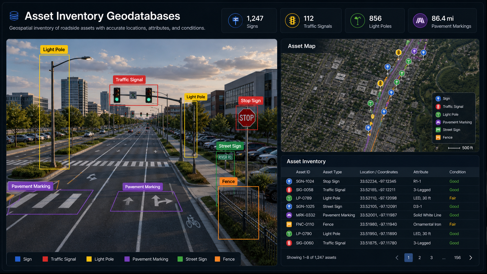
Asset Inventory Geodatabases
Full asset inventory geodatabases for pavement segments, signs, markings, and related infrastructure. PAVER, Cartegraph, and ArcGIS-compatible. Supports multi-year tracking and agency reporting.
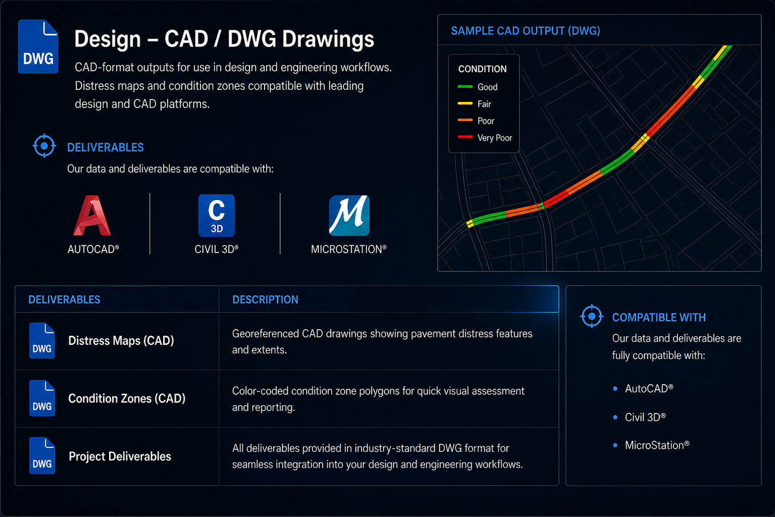
CAD / DWG Drawings
CAD-format outputs for use in design and engineering workflows. Distress maps, condition zones, and orthomosaic underlays compatible with AutoCAD, Civil 3D, and MicroStation.
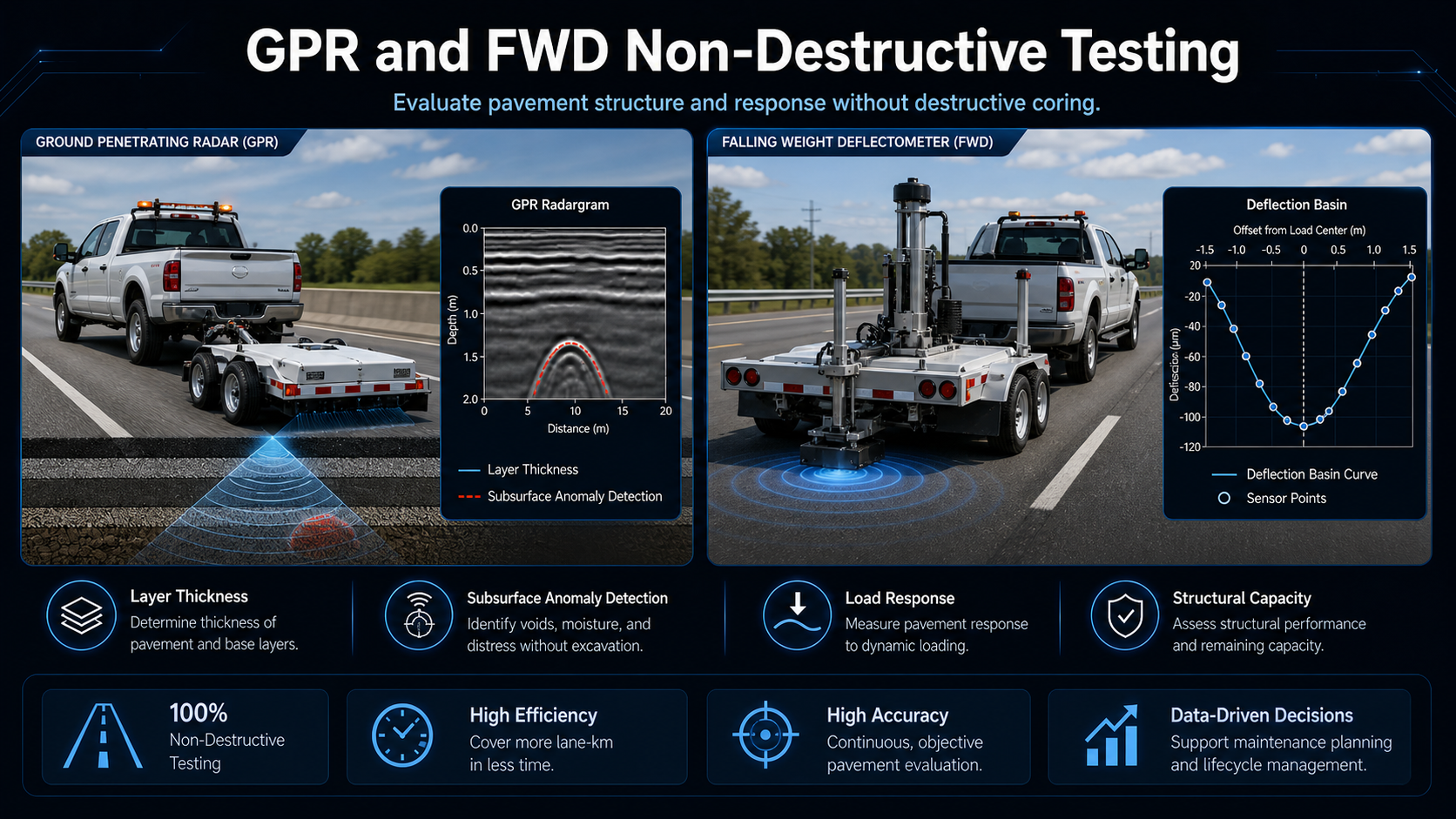
FWD & GPR Test Reports
Structural and subsurface test results including FWD deflection data, backcalculated layer moduli, load transfer efficiency, and GPR layer thickness profiles with anomaly identification.