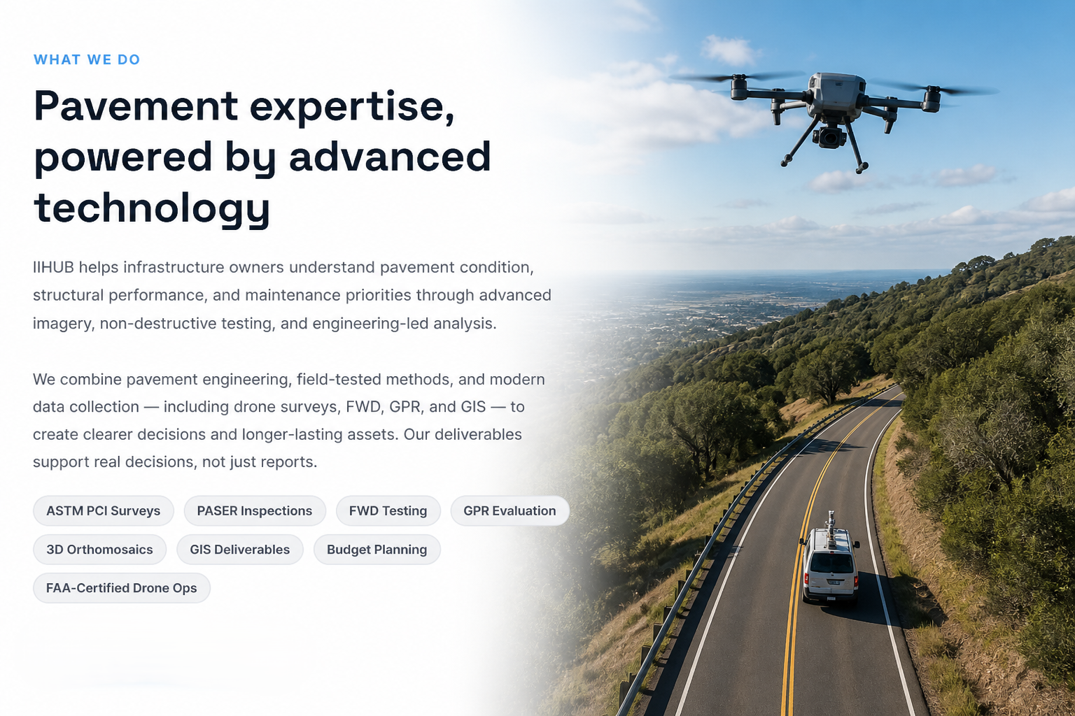
ASTM-based pavement surveys, PASER inspections, FWD, GPR, 3D models, GIS deliverables, and pavement planning — for airports, cities, counties, DOTs, and private owners.
Who We Serve
Our Services
From condition survey to multi-year maintenance planning, IIHUB covers every step of the assessment and decision-support workflow.
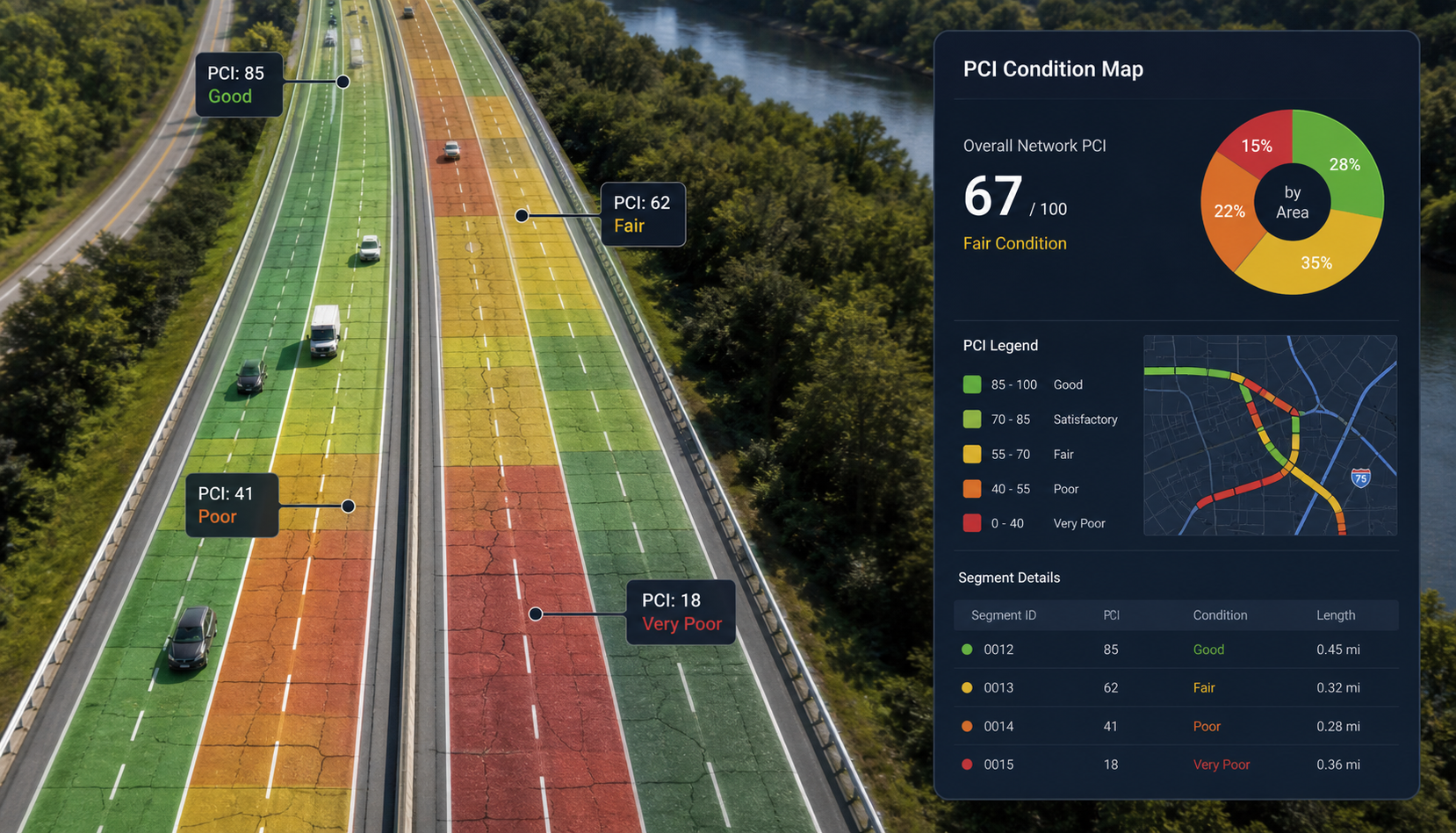
ASTM D6433-compliant PCI surveys with geotagged imagery, distress maps, orthomosaics, crack overlays, and PAVER-compatible outputs. Computer-vision-assisted distress rating for objective, scalable results.
Learn more →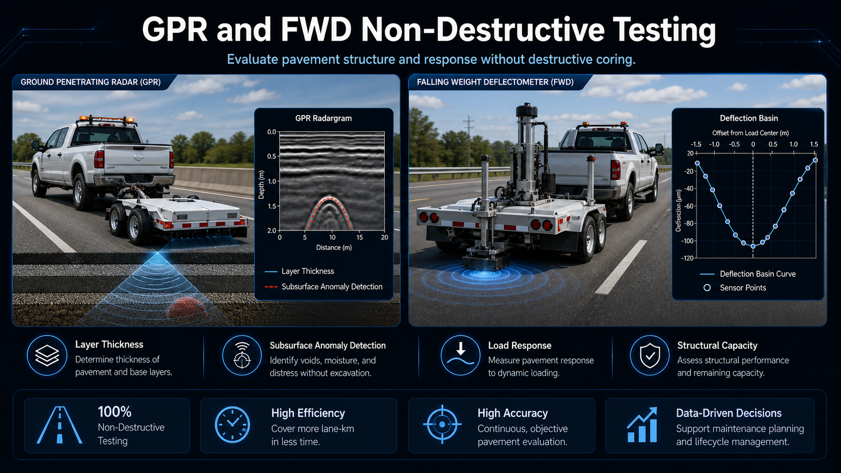
Structural capacity evaluation with FWD (load transfer, backcalculation, void detection) and subsurface assessment with GPR (layer thickness, voids, utilities, bridge deck evaluation).
Learn more →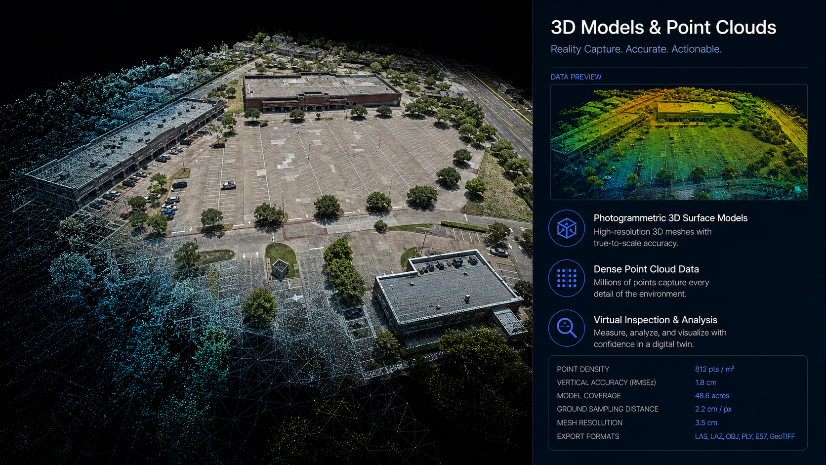
Geo-referenced orthomosaics and 3D models for analysis, design, communication, and long-term asset management. High-resolution TIFF outputs, pointclouds, and navigable digital models.
Learn more →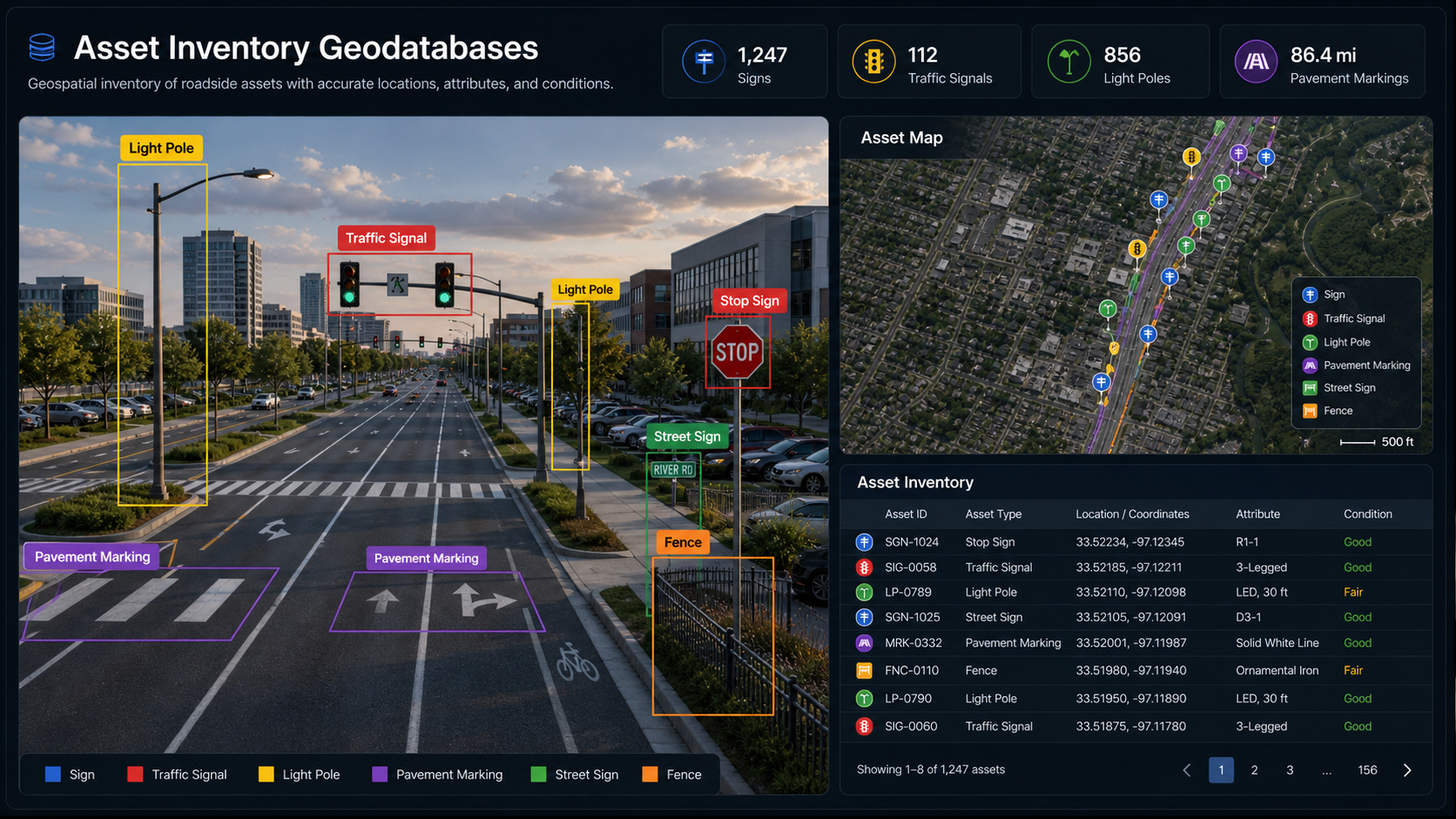
Asset inventory geodatabases, shapefiles, KML/Google Earth outputs, annotated maps, and GIS-ready deliverables that integrate directly into your existing asset management systems.
Learn more →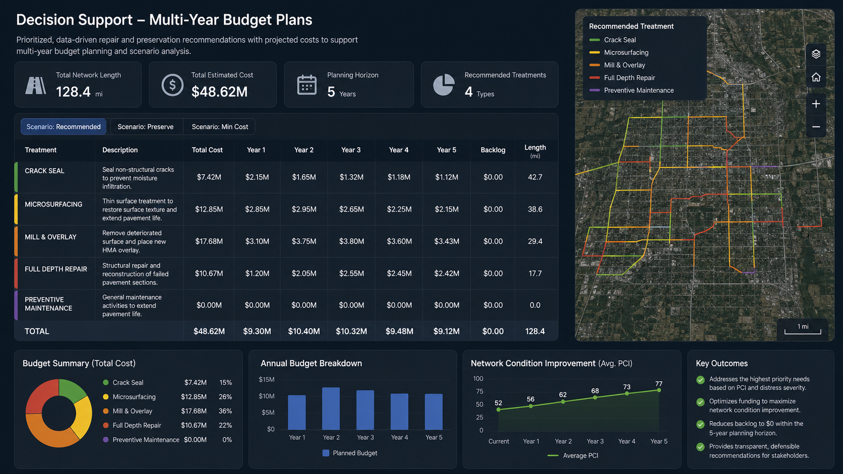
Beyond survey and testing — pavement management strategy, scenario planning, rehabilitation prioritization, and multi-year capital improvement plans that support defensible budget decisions.
Learn more →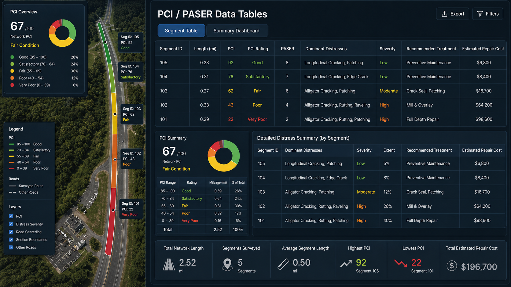
Network-level PASER ratings (scale 1–10) for efficient pavement screening. An appropriate first-pass tool for clients who need a practical, cost-effective view of their entire road or facility network.
Learn more →Why IIHUB
We position ourselves as infrastructure engineering specialists who use advanced technology — not a drone company that does engineering on the side.
A multidisciplinary team of PhDs, Professional Engineers, FAA-certified drone pilots, data scientists, and NDT specialists. Our work is led by engineers, not technicians.
Every survey follows ASTM D6433, ASTM E950, AASHTO guidelines, and FAA advisory circulars. Our QA/QC process and documentation stand up to agency scrutiny.
High-resolution drone imagery, LiDAR, FWD, GPR, and AI-assisted distress rating — integrated into GIS-ready deliverables, 3D models, and interactive maps.
Our reports are decision tools, not data dumps. Maintenance prioritization, capital improvement schedules, scenario-based budget models, and PAVER-compatible outputs.
Sample Projects
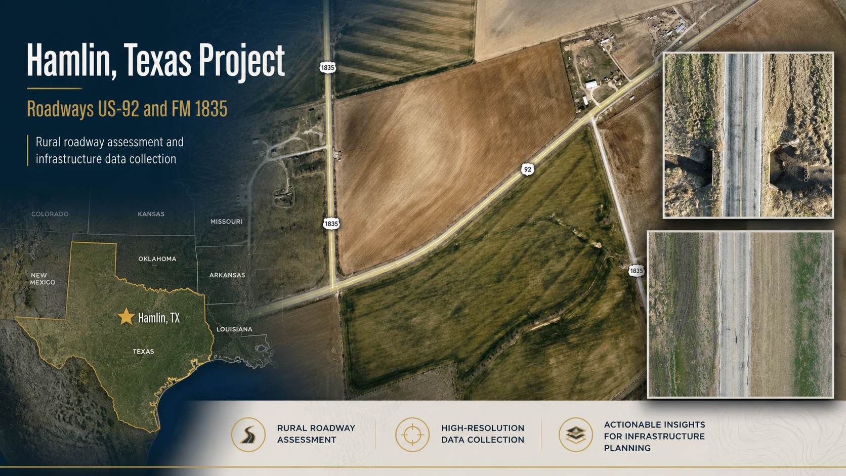
From municipal road networks to international airport pavements, our surveys deliver consistent, engineering-grade results.
Full ASTM D6433 PCI survey of the municipal road network. Geotagged distress imagery, PCI maps, GIS-ready shapefiles, and maintenance prioritization report delivered to the city engineer.
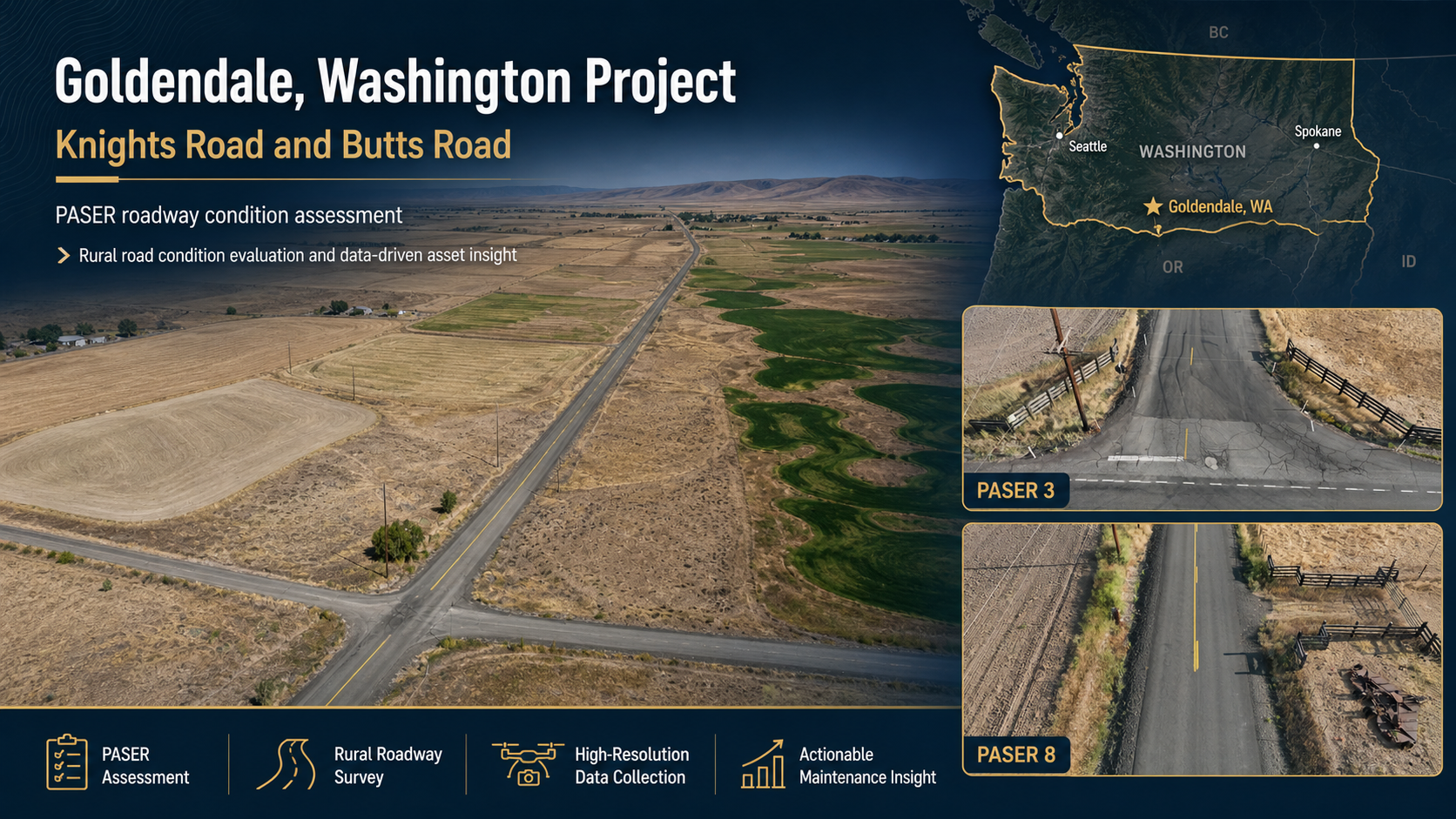
Network-level PASER pavement rating survey for the City of Goldendale. Efficient screening of all city-maintained roads, with distress documentation and prioritization outputs.
Full ASTM PCI condition assessment of an industrial facility pavement network. Geo-referenced distress maps, orthomosaic outputs, and a prioritized repair schedule with cost estimates.
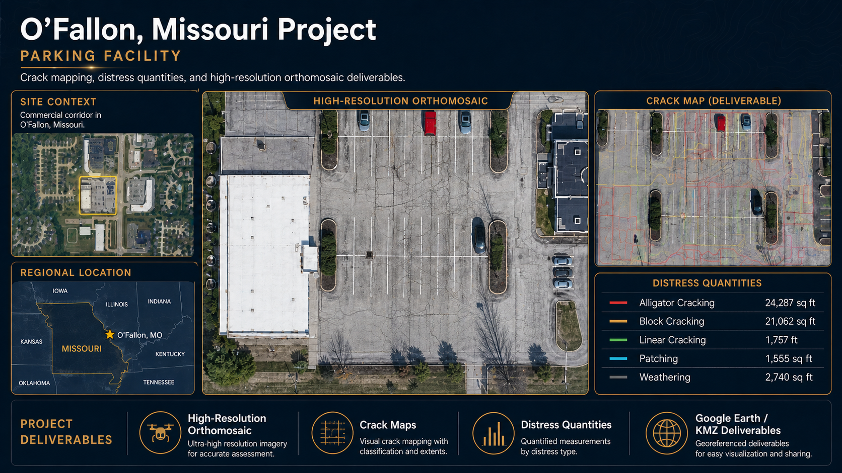
ASTM PCI assessment of a commercial parking facility. Distress documentation, orthomosaic mapping, CAD and GIS outputs, striping/marking evaluation, and phased repair prioritization report.
We'll help you determine the most appropriate survey, testing methodology, and deliverables for your project — whether it's a parking lot, road network, or major airport runway.